 Goal: Develop the regional trail system
Initiatives
Support development of the Chattahoochee to Bristol (C2B) Trail along the eastern bank of the Apalachicola River.
Support development of the Old Spanish Trail (including tying into the North Star Legacy Communities).
Support development of amenities along the Apalachicola Blueway Paddle Trail.

Florida National Scenic Trail
The Florida National Scenic Trail traverses 1,500 miles from the Big Cypress National Preserve in South Florida to the Gulf Island National Seashore in the western Panhandle. However, an additional 300 miles of the Florida National Scenic Trail are in the planning phase to connect the Apalachicola National Forest to the Econfina Creek Water Management Area.
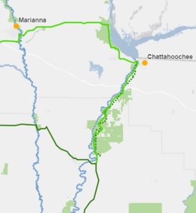
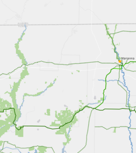
The Florida National Scenic Trail has a major opportunity to enhance the Panhandle route of the trail that mainly runs along state highways. This section is currently a road walk and does not meet the scenic and safety goals of the Florida National Scenic Trail. The U.S. Forest Service contracted with the Florida Planning and Development Lab at Florida State University to identify an alternative route to the existing trail. The Lab recommended a route that passes through Torreya State Park, Three Rivers State Park and Apalachee Wildlife Management Area as well as the Cities of Chattahoochee and Marianna. The alternative route would provide the most recreational opportunities through a variety of cultural landscapes, communities and public lands.
Additional Resources
Chattahoochee to Bristol Trail (C2B)
The Apalachee Regional Planning Council received a Community Planning Technical Assistance Grant from the Florida Department of Economic Opportunity to evaluate the feasibility of a trail along the eastern bank of the Apalachicola River between Chattahoochee and Bristol. The feasibility study documents proposed routes and potential access points for the C2B Trail. Development of the C2B Trail could drive renewed interest in the Florida National Scenic Trail and connect additional recreational opportunities, cultural as well as historical sites and new downtown community links to recreational hikers and further enhance the regional economy.
Over the course of the study, local stakeholders identified that recreational, historical and cultural assets could be more effectively utilized by improving regional connectivity. They shared their support for a regional trail that could tie together underutilized assets and position communities as vibrant centers for tourism. Of the stakeholders engaged, Explore Northwest Florida (then Riverway South), Apalachicola Riverkeeper and Chattahoochee Main Street expressed interest in championing the implementation of the C2B Trail.
Additional Resources
Old Spanish Trail
The Old Spanish Trail follows a historic east-west road, built in the 1920s as a tourist route that begins in St. Augustine, Florida. The Old Spanish Trail Corridor is a planned regional priority trail that travels along the path of the Old Spanish Trail from Pensacola to St Augustine. Upon completion, the trail will connect Marianna, Chattahoochee and Quincy. The trail corridor will connect community cultural and historical resources through hiking and biking connections across much of the northern Panhandle.
Additional Resources
- Five individual studies for each county
- Visit Florida – https://www.visitflorida.com/en-us/things-to-do/outdoors-nature/old-spanish-trail.html
- Florida Greenways and Trails System Plan
- Washington County Master Plan
- Jackson County Master Plan
- Walton US-90 Corridor Master Plan
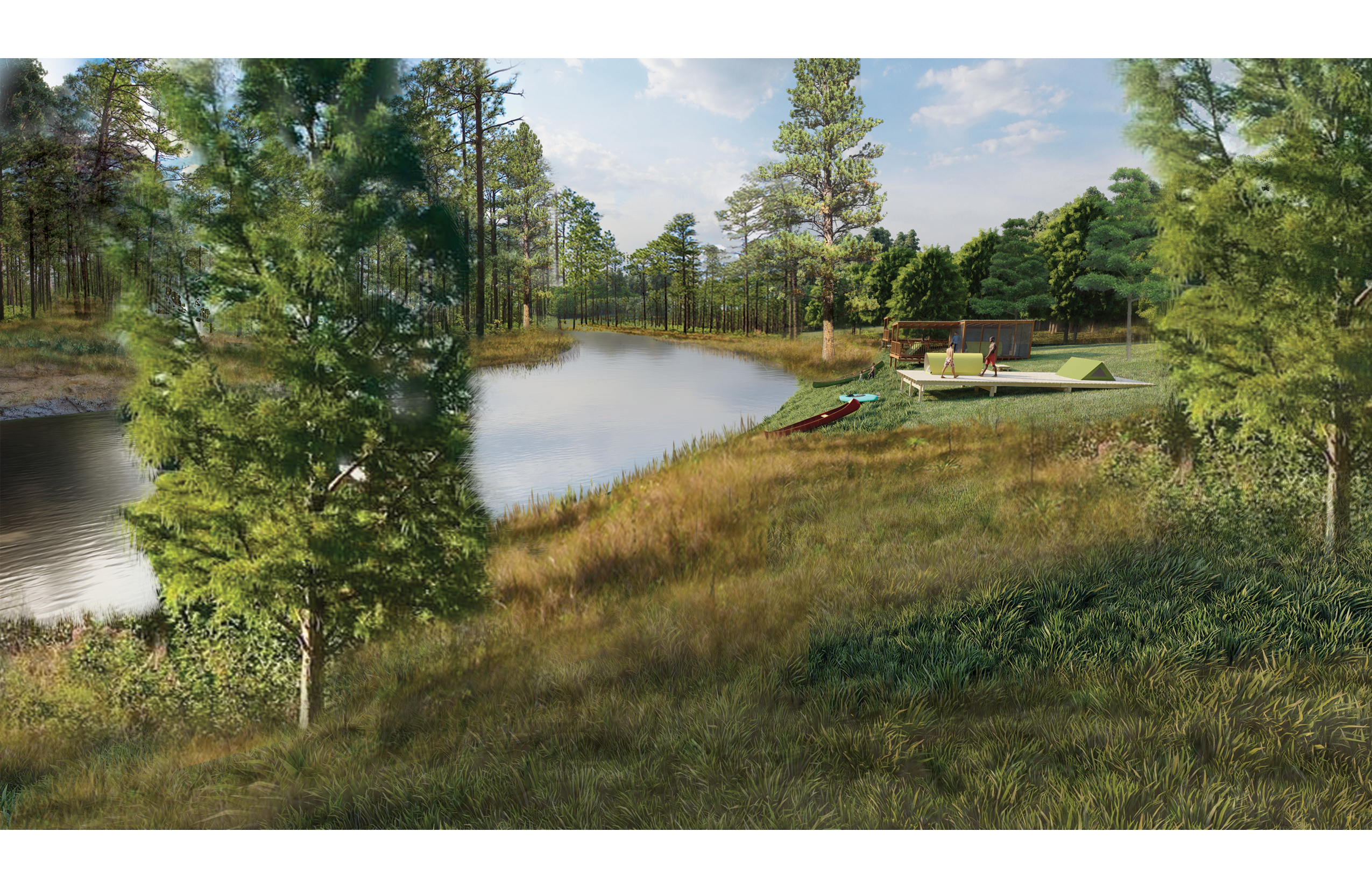
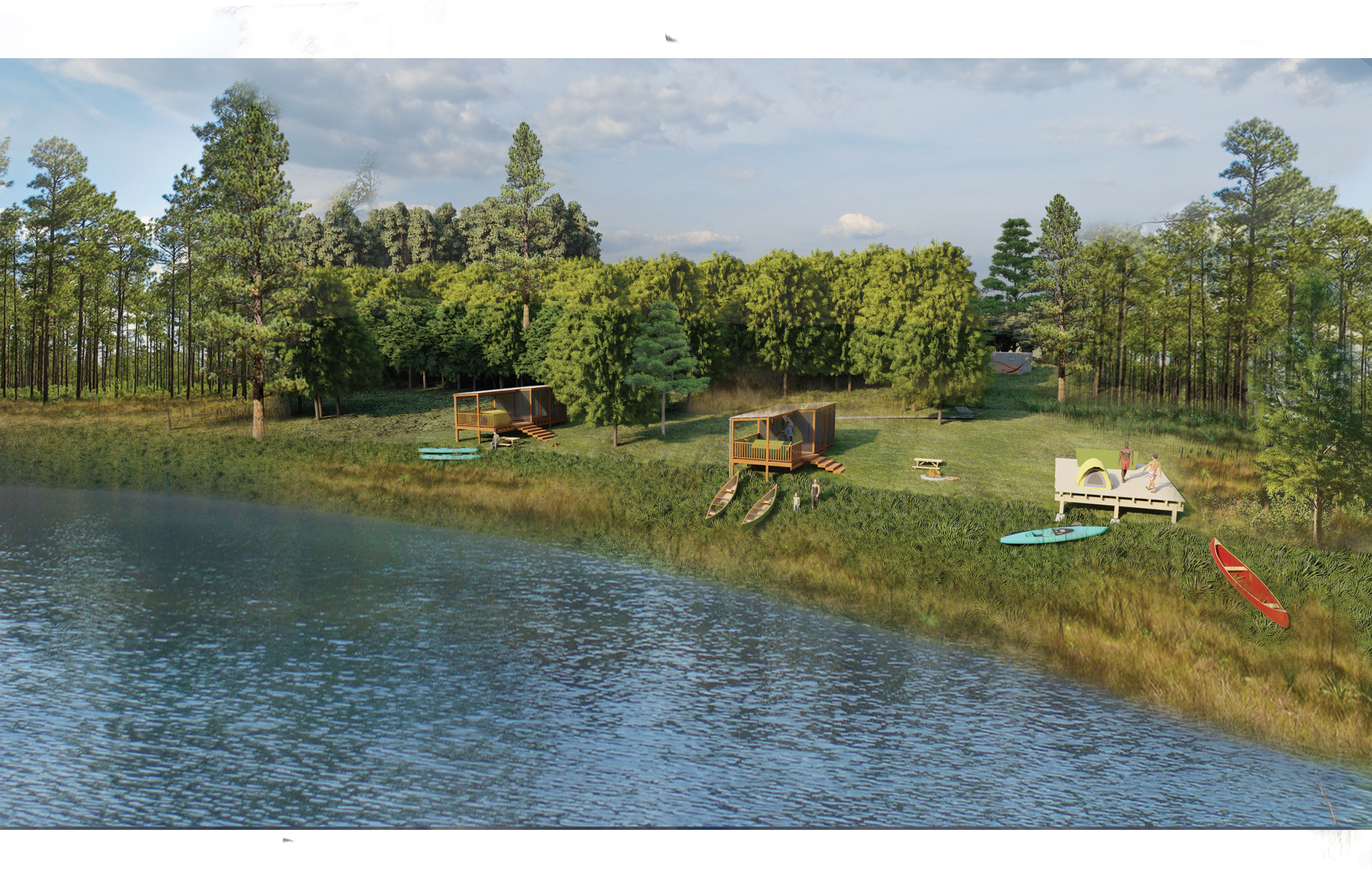
Examples of different types of camping platforms to support paddle trails.
(click on image to enlarge)
Apalachicola Blueway Paddle Trail
The Apalachicola River is well-known for its recreational and ecological significance. The Apalachicola River provides habitats for several rare plants and animals that do not occur elsewhere in the state, including the rare Torreya tree species. The Florida Department of Environmental Protection designated the Apalachicola River as an “Outstanding Florida Water” and a high priority under the Florida Forever Priority List.
Apalachicola Blueway Ecotourism Needs (especially during high water when sandbars are inundated)
The blueway begins at Jim Woodruff Dam at river mile 106
- River mile 94, Ocheesee Landing, Calhoun County: need for restroom facilities
- River mile 89, Redd’s Landing, Calhoun County: need for restroom facilities
- River mile 80, Bristol Landing, Liberty County: need for primitive camping site(s)
- River mile 77, Neal Landing, Calhoun County: need for primitive camping site(s)
- River mile 42, Gaskin Park, Gulf County: need for primitive camping site(s)
Additional Resources
- Apalachicola River Blueway website
- Apalachicola Basin Trail Guide
- Trail Maps and Data (Apalachicola River Keeper)
- Overview of Florida’s Designated Paddling Trails (FDEP)